Hogreen Air Develops Drone with Online 3D Mapping and Real-time Obstacle Detection
Dec. 29. 2023Page info
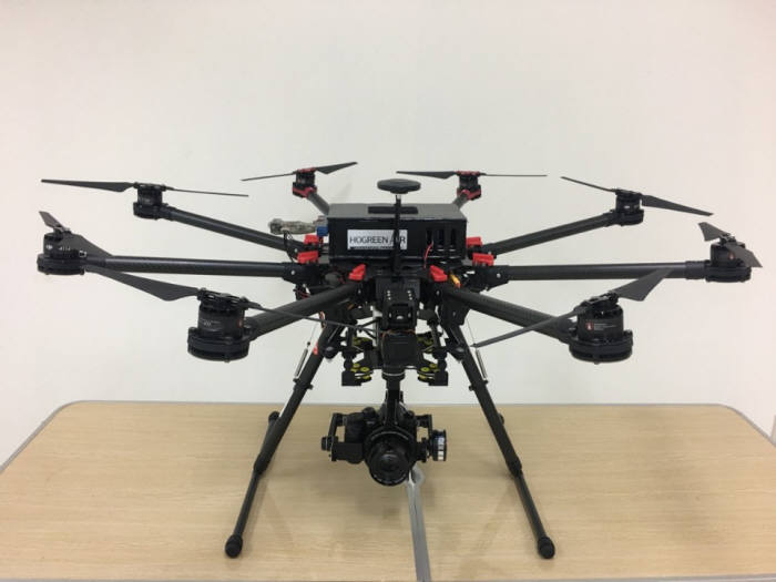
A South Korean SME, Hogreen Air, has developed a high-quality drone capable of online 3D mapping and real-time obstacle detection. This innovation is expected to contribute to the widespread use of drones across various industries.
Hogreen Air, specializing in drone development, announced on the 13th that it has developed a drone equipped with object recognition sensors, such as LiDAR and cameras, enabling online 3D mapping and real-time obstacle detection.
The drone developed by the company utilizes an onboard system that combines LiDAR and cameras to scan specific areas, process 3D mapping tasks online, and detect or avoid obstacles in its flight path.
This drone, with independent LiDAR and camera systems, creates waypoints, representing geographic coordinates that indicate the flight path, by 3D mapping the terrain. It calculates the subsequent waypoint positions based on the initially scanned waypoints, precisely aligns the multitude of point cloud data in different coordinate systems, and merges them sequentially into a single 3D map. The drone then continuously captures images through the camera and acquires data through LiDAR during waypoint movement, automatically generating a precise 3D map with color information online.
The drone is equipped with sensors capable of recognizing the size of objects within 270 degrees within a 30m range in the direction of travel, allowing it to assess and avoid obstacles. This feature prevents the drone from colliding, crashing, or causing harm to individuals.
Notably, the drone overcomes the limitations of traditional LiDAR, which requires specialized devices such as high-end sensors and polarizing filters to obtain precise data. It also addresses the inefficiency of 2D image-based 3D mapping using cameras in areas with sensitive lighting and textureless surfaces.
Hogreen Air emphasized that even individuals without advanced piloting skills can conduct online 3D mapping tasks in a short time without complex post-processing mapping operations.
The company plans to expand the application of this technology to a wide range of areas, including autonomous reconnaissance and surveillance drones, automatic 3D map creation drones, and logistics and transportation robots.
CEO Hong Sung-ho stated, "The online 3D mapping system and obstacle detection and avoidance functions of drones represent cutting-edge technology being actively developed in advanced countries." He added, "Leveraging long-distance communication and real-time image processing technologies, we will actively contribute to the popularization of drones."
